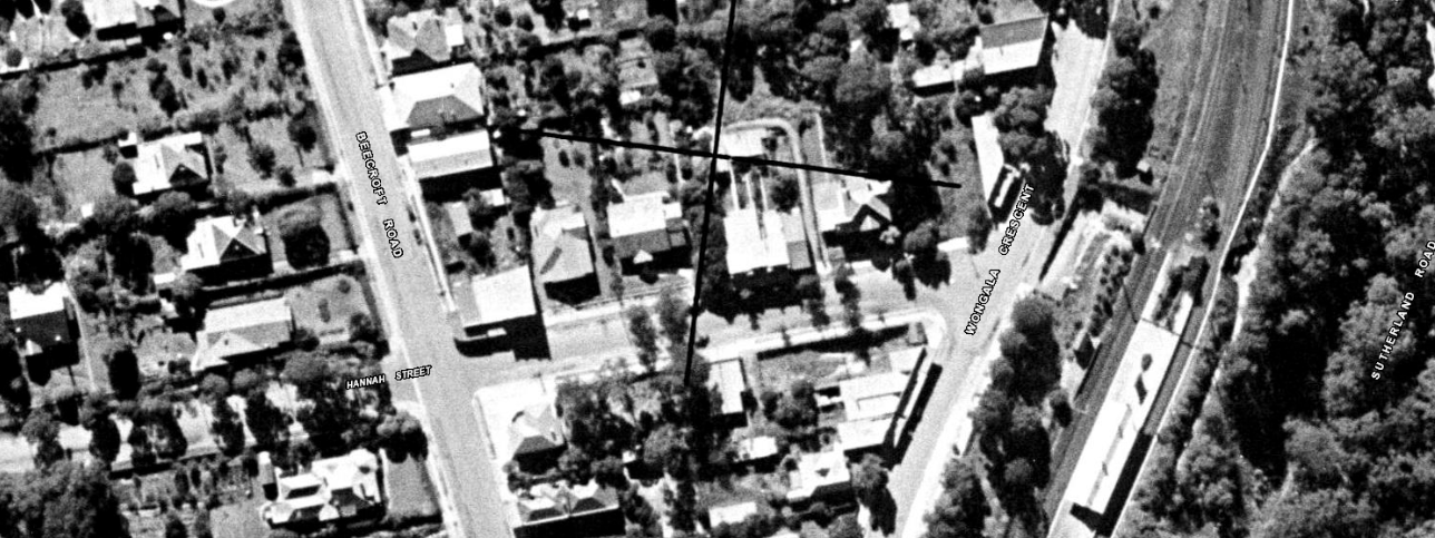
Image: 14B hannah
1943 aerial photo of the study site and the Hannah Street (east) streetscape. The study site at that time was a tree-filled block, with a mix of commercial and residential development present in the street. Lot marked with arrow. [SIX Maps]